File:Greece, Turkey and Cyprus.png
Jump to navigation
Jump to search
Size of this preview: 800 × 453 pixels. Other resolutions: 320 × 181 pixels | 640 × 363 pixels | 1,024 × 580 pixels | 1,280 × 725 pixels | 2,501 × 1,417 pixels.
Original file (2,501 × 1,417 pixels, file size: 249 KB, MIME type: image/png)
This is a file from the Wikimedia Commons. Information from its description page there is shown below.
Commons is a freely licensed media file repository. You can help. |
Summary
| Description |
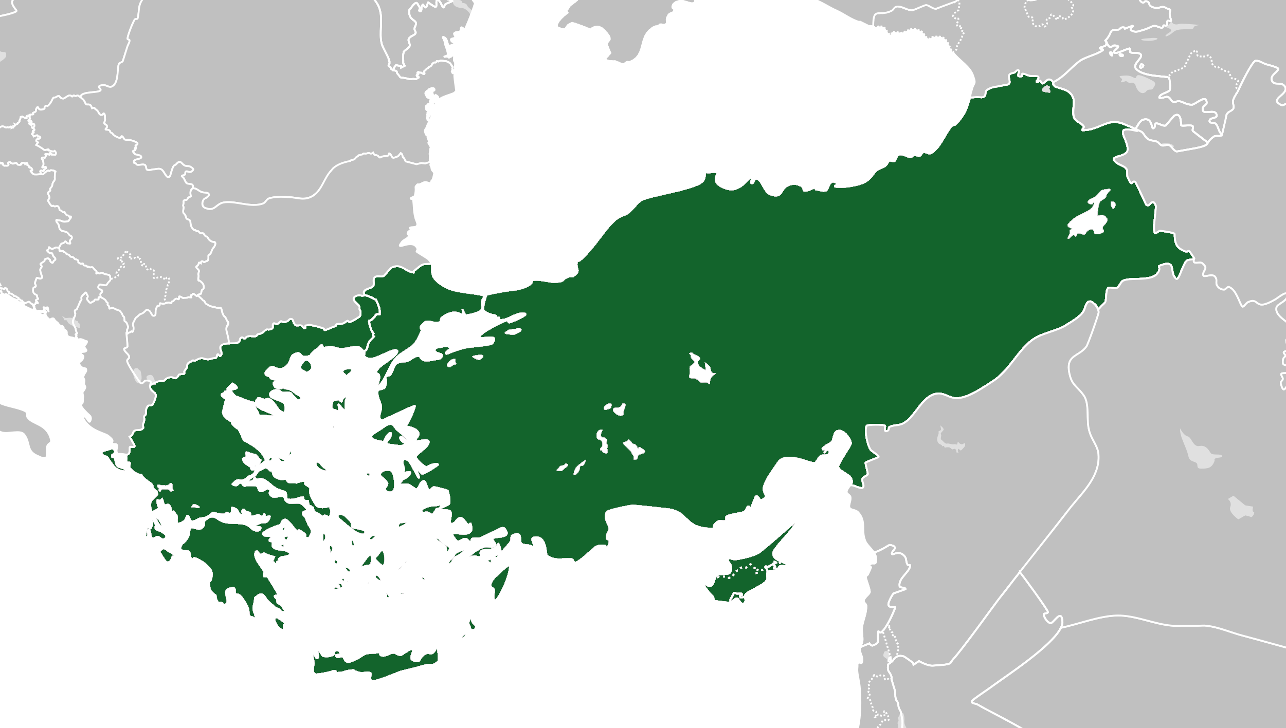
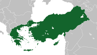
English: Locator map of a hypothetical union between Greece, Turkey and Cyprus. |
| Date | |
| Source | File:Blank map of Europe (with disputed regions).svg |
| Author |
maix (original image) Ichthyovenator (derivative work) |
.svg)
Licensing
This file is licensed under the Creative Commons Attribution-Share Alike 4.0 International license.
- You are free:
- to share – to copy, distribute and transmit the work
- to remix – to adapt the work
- Under the following conditions:
- attribution – You must give appropriate credit, provide a link to the license, and indicate if changes were made. You may do so in any reasonable manner, but not in any way that suggests the licensor endorses you or your use.
- share alike – If you remix, transform, or build upon the material, you must distribute your contributions under the same or compatible license as the original.
File history
Click on a date/time to view the file as it appeared at that time.
| Date/Time | Thumbnail | Dimensions | User | Comment | |
|---|---|---|---|---|---|
| current | 19:04, 16 July 2020 | | 2,501 × 1,417 (249 KB) | Ichthyovenator | Uploaded own work with UploadWizard |
File usage
The following page uses this file:
Global file usage
The following other wikis use this file:
- Usage on el.wikipedia.org
- Usage on ru.wikipedia.org
- Usage on zh.wikipedia.org