File:LocationCzechRepublic.png
Jump to navigation
Jump to search
No higher resolution available.
LocationCzechRepublic.png (250 × 115 pixels, file size: 6 KB, MIME type: image/png)
This is a file from the Wikimedia Commons. Information from its description page there is shown below.
Commons is a freely licensed media file repository. You can help. |
Summary
Magyar: A Cseh Köztársaság elhelyezkedése
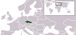
English: Location map for the Czech Republic. Originally created for English Wikipedia by Vardion.
Licensing
| |
This work has been released into the public domain by its author, Vardion, at the English Wikipedia project. This applies worldwide. In case this is not legally possible: |

|
File:LocationCzechRepublic.svg is a vector version of this file. It should be used in place of this PNG file when not inferior.
File:LocationCzechRepublic.png → File:LocationCzechRepublic.svg
For more information, see Help:SVG. |
 |
File history
Click on a date/time to view the file as it appeared at that time.
| Date/Time | Thumbnail | Dimensions | User | Comment | |
|---|---|---|---|---|---|
| current | 16:28, 6 June 2006 | | 250 × 115 (6 KB) | Rain74 | Montenegro |
| 20:39, 5 December 2004 |  | 250 × 115 (7 KB) | EugeneZelenko | Location map for the Czech Republic.<br/>Originally created for English Wikipedia by Vardion.<br/>{{GFDL}} |
File usage
The following 3 pages use this file:
Global file usage
The following other wikis use this file:
- Usage on arc.wikipedia.org
- Usage on av.wikipedia.org
- Usage on awa.wikipedia.org
- Usage on bg.wikipedia.org
- Usage on bpy.wikipedia.org
- Usage on br.wikipedia.org
- Usage on bs.wikiquote.org
- Usage on csb.wikipedia.org
- Usage on de.wikipedia.org
- Usage on de.wikinews.org
- Usage on el.wiktionary.org
- Usage on en.wikipedia.org
- Usage on en.wikinews.org
- Usage on en.wikivoyage.org
- Usage on fa.wikinews.org
- Usage on fiu-vro.wikipedia.org
- Usage on he.wikivoyage.org
- Usage on hi.wikipedia.org
- Usage on hr.wikipedia.org
- Usage on ia.wikipedia.org
- Usage on incubator.wikimedia.org
- Usage on it.wikinews.org
- Usage on ja.wiktionary.org
- Usage on jv.wikipedia.org
- Usage on kk.wikipedia.org
- Usage on ko.wikipedia.org
- Usage on ko.wiktionary.org
- Usage on ky.wikipedia.org
- Usage on la.wiktionary.org
- Usage on lij.wikipedia.org
- Usage on li.wikipedia.org
- Usage on lt.wiktionary.org
- Usage on lv.wiktionary.org
- Usage on nds-nl.wikipedia.org
- Usage on nds.wiktionary.org
View more global usage of this file.