File:Netherlands Antilles-CIA WFB Map.png
Jump to navigation
Jump to search
No higher resolution available.
Netherlands_Antilles-CIA_WFB_Map.png (326 × 351 pixels, file size: 8 KB, MIME type: image/png)
This is a file from the Wikimedia Commons. Information from its description page there is shown below.
Commons is a freely licensed media file repository. You can help. |
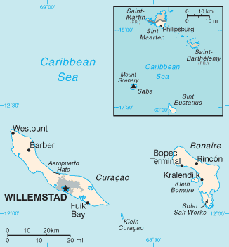
Summary
| Description |
Español: Mapa Antillas Neerlandesas |
|||
| Date | ||||
| Source | CIA, The World Factbook, 2005 http://www.cia.gov/cia/publications/factbook/maps/nt-map.gif | |||
| Author | CIA | |||
| Permission (Reusing this file) |
|

derivative works
Derivative works of this file:
File history
Click on a date/time to view the file as it appeared at that time.
| Date/Time | Thumbnail | Dimensions | User | Comment | |
|---|---|---|---|---|---|
| current | 22:44, 5 August 2010 | | 326 × 351 (8 KB) | Ras67 | cropped |
| 09:05, 30 January 2006 |  | 329 × 353 (10 KB) | Hoshie | Updated map of the Netherlands Antilles from the CIA Factbook, 10 Jan 06 rev: http://www.cia.gov/cia/publications/factbook/maps/nt-map.gif | |
| 09:16, 27 March 2005 |  | 329 × 354 (6 KB) | Wolfman~commonswiki | {{CIA-map}} |
File usage
The following page uses this file:
Global file usage
The following other wikis use this file:
- Usage on cy.wikipedia.org
- Usage on en.wikipedia.org
- Usage on en.wikisource.org
- Usage on es.wikipedia.org
- Usage on es.wikinews.org
- Usage on fa.wikipedia.org
- Usage on fi.wikipedia.org
- Usage on fr.wikipedia.org
- Usage on hu.wikipedia.org
- Usage on it.wikipedia.org
- Usage on lfn.wikipedia.org
- Usage on lt.wikipedia.org
- Usage on mk.wikipedia.org
- Usage on no.wikipedia.org
- Usage on pl.wikipedia.org
- Usage on pl.wikivoyage.org
- Usage on pt.wikipedia.org
- Usage on ru.wikipedia.org
- Usage on sah.wikipedia.org
- Usage on sv.wikipedia.org
- Usage on th.wikipedia.org
- Usage on tr.wikipedia.org
- Usage on tr.wiktionary.org
- Usage on uk.wikipedia.org
- Usage on www.wikidata.org
- Usage on zh-min-nan.wikipedia.org