File:Wfm jura landsat.jpg
Jump to navigation
Jump to search

Size of this preview: 800 × 593 pixels. Other resolutions: 320 × 237 pixels | 640 × 474 pixels | 1,024 × 758 pixels | 1,280 × 948 pixels.
Original file (1,280 × 948 pixels, file size: 328 KB, MIME type: image/jpeg)
This is a file from the Wikimedia Commons. Information from its description page there is shown below.
Commons is a freely licensed media file repository. You can help. |
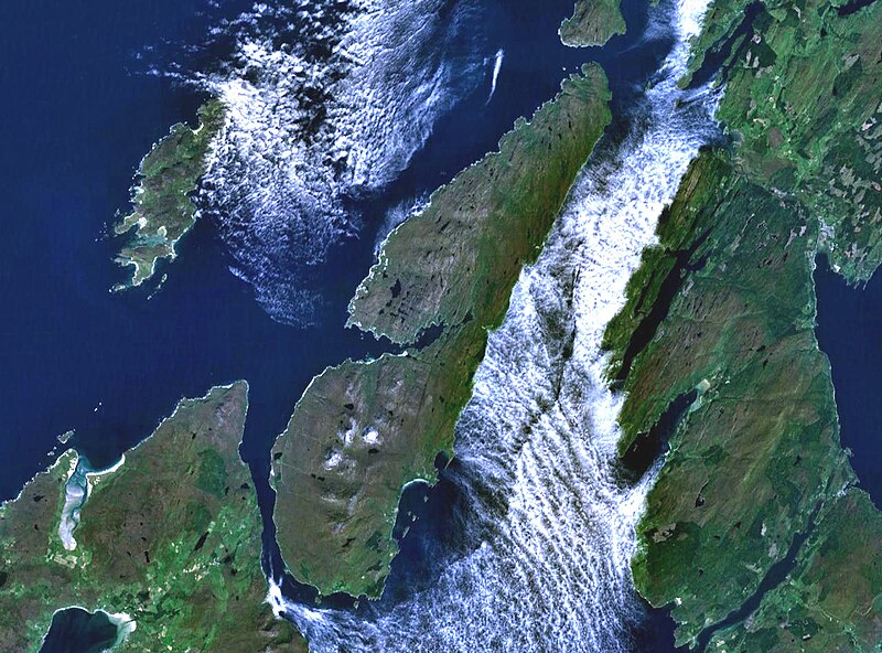
The island of Jura off the west coast of Scotland. The large island to the southwest is Islay, and north of it is Colonsay. To the east is the Kintyre peninsula. The small round island just to the north is Scarba.
This is Landsat7 imagery, collected using NASA World Wind.
| This image is in the public domain because it is a screenshot from NASA’s globe software World Wind using a public domain layer, such as Blue Marble, MODIS, Landsat, SRTM, USGS or GLOBE.
|
 |
File history
Click on a date/time to view the file as it appeared at that time.
| Date/Time | Thumbnail | Dimensions | User | Comment | |
|---|---|---|---|---|---|
| current | 19:48, 4 August 2005 | | 1,280 × 948 (328 KB) | Finlay McWalter | The island of Jura off the west coast of Scotland. This is Landsat7 imagery, collected using NASA World Wind. {{PD-USGov-NASA}} category:islands category:scotland category:satellite photos |
File usage
The following page uses this file:
Global file usage
The following other wikis use this file:
- Usage on br.wikipedia.org
- Usage on cs.wikipedia.org
- Usage on de.wikipedia.org
- Usage on el.wikipedia.org
- Usage on en.wikipedia.org
- Scarba
- Craighouse
- Feolin
- Beinn an Òir
- Beinn Shiantaidh
- Beinn a' Chaolais
- Paps of Jura
- Ardfernal
- Ardmenish
- Jura, Scotland
- Barnhill, Jura
- List of listed buildings in Jura, Argyll and Bute
- Ardlussa Fishing Loch
- Ardfin
- Small Isles, Argyll
- Template:Jura
- Am Fraoch Eilean
- Brosdale Island
- Lagg, Jura
- Tarbert, Jura
- Keils
- Inverlussa
- Kinuachdrachd
- Ardlussa
- Knockrome
- Usage on es.wikipedia.org
- Usage on fr.wikipedia.org
- Usage on gl.wikipedia.org
- Usage on it.wikipedia.org
- Usage on ja.wikipedia.org
- Usage on la.wikipedia.org
- Usage on nds.wikipedia.org
- Usage on nl.wikipedia.org
- Usage on nn.wikipedia.org
- Usage on no.wikipedia.org
- Usage on pl.wikipedia.org
- Usage on pt.wikipedia.org
- Usage on sr.wikipedia.org
- Usage on sv.wikipedia.org
- Usage on uk.wikipedia.org
- Usage on www.wikidata.org